 vesseltracker.com
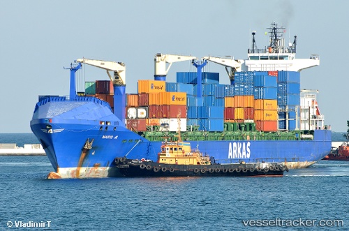
Find the position of the vessel Mario A on the map. The latter are known coordinates and path.
marine traffic ship tracker show on live map
The current position of vessel Mario A is 14.6871 lat / -17.4277 lng. Updated: 2024-04-23 10:59:16 UTCCurrently sailing under the flag of Malta
Mario A built in 2007 year
Port of registry:
İzmir (city in İzmir Province, Turkey)Deadweight:
22016 tPayload_mass:
22016 tonneGross tonnage:
17687Operator:
ARKAS Line (shipping company of Turkey)Service entry:
2007-01-01T00:00:00ZManufacturer:
Peene-Werft (German company)
Details:
Last coordinates of the vessel:
UTC, 14.6867, -17.4267, course: -1, speed: 0UTC, 14.6872, -17.4277, course: 331, speed: 0
UTC, 14.6872, -17.4277, course: 331, speed: 0
2024-04-23 10:59:16 UTC, 14.6871, -17.4277, course: 331, speed: 0