vessel 538009531 IMO: 9624457, vesseltracker.com
Vessel 538009531 IMO: 9624457,
MMSI: 538009531 callsign: size: x

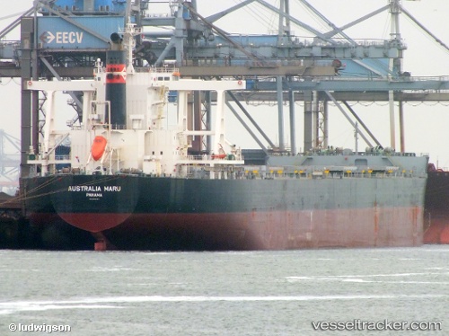
Find the position of the vessel 538009531 on the map. The latter are known coordinates and path.

marine traffic ship tracker show on live map

The current position of vessel 538009531 is -33.029296666667 lat / 17.985823333333 lng. Updated: 2025-09-17 23:17:53 UTC
Details:


Last coordinates of the vessel:
UTC, -32.65698, 18.085116666667, course: 273, speed: 0
UTC, -33.106208333333, 17.78829, course: 99, speed: 6.8
UTC, -33.029296666667, 17.98583, course: 201, speed: 0.1
2025-09-17 23:17:53 UTC, -33.029296666667, 17.985823333333, course: 201, speed: 0

Track of the vessel in the last 14 days


Most frequent ports a vessels calls at 538009531 (538009531):

Sitrah Anchorage, traffic: 2
Vishakhapatnam, traffic: 2
Durban, traffic: 2
Ijmuiden, traffic: 2
Kali Limenes, traffic: 1
Korsor, traffic: 1
Saldanha Bay, traffic: 1
Sambu, traffic: 1
Sept Iles, traffic: 1
Singapore, traffic: 1
Cape Of Good Hope, traffic: 1
Wu-Sung, traffic: 1
Wusong, traffic: 1

Link to the map:


Find another ship

538009531 (538009531) last ports (portcalls and passsages)

Cape Of Good Hope | 2023-12-21 12:53:32
Korsor | 2022-12-30 17:26:53
Kali Limenes | 2022-12-11 11:28:49
Wusong | 2022-09-26 04:39:49
Singapore | 2022-07-03 23:00:50
Sambu | 2022-07-03 22:04:21
Saldanha Bay | 2022-06-10 04:17:11
Sitrah Anchorage | 2022-05-21 07:51:32
Sitrah Anchorage | 2022-05-17 07:22:22
Sept Iles | 2022-04-04 15:16:56
Ijmuiden | 2022-03-16 12:00:39
Durban | 2022-01-12 13:50:21
Vishakhapatnam | 2021-12-22 08:15:01