 vesseltracker.com
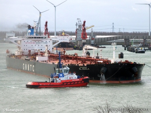
Find the position of the vessel Al Agaila on the map. The latter are known coordinates and path.
marine traffic ship tracker show on live map
The current position of vessel Al Agaila is 25.3953 lat / 56.6853 lng. Updated: 2024-04-20 02:27:29 UTCCurrently sailing under the flag of Libya
Payload_mass:
164787 tonneGross tonnage:
84735Service entry:
2009-01-01T00:00:00ZManufacturer:
Hyundai Samho Heavy Industries (company)Details:
Last coordinates of the vessel:
UTC, 25.5383, 56.8231, course: 177, speed: 11.4UTC, 25.4881, 56.8317, course: 171, speed: 11.2
UTC, 25.4109, 56.817, course: 208, speed: 11.2
2024-04-20 02:27:29 UTC, 25.3953, 56.6853, course: 270, speed: 5.9