 vesseltracker.com
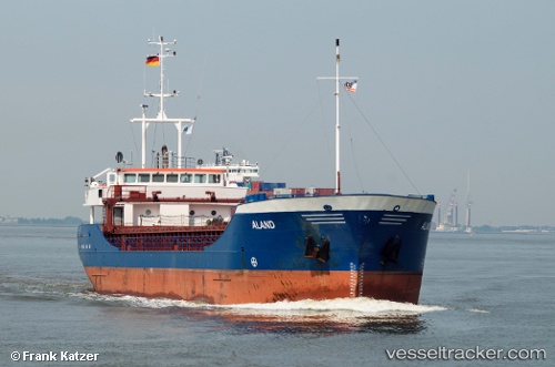
Find the position of the vessel Aland on the map. The latter are known coordinates and path.
marine traffic ship tracker show on live map
The current position of vessel Aland is 53.8591 lat / 8.98112 lng. Updated: 2024-04-20 00:49:50 UTCCurrently sailing under the flag of Germany
Aland built in 1996 year
Deadweight:
3246 tPayload_mass:
3246 tonneGross tonnage:
1996Service entry:
1996-01-01T00:00:00ZManufacturer:
Scheepswerf Peters, KampenDetails:
Last coordinates of the vessel:
UTC, 53.8596, 8.98459, course: 276, speed: 0.1UTC, 53.8583, 8.98333, course: -1, speed: 0
UTC, 53.8586, 8.98324, course: 4, speed: 0
2024-04-20 00:49:50 UTC, 53.8591, 8.98112, course: 63, speed: 0.3