 vesseltracker.com
Find the position of the vessel CAP GUILLAUME on the map. The latter are known coordinates and path.
marine traffic ship tracker show on live map
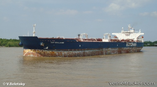
The current position of vessel CAP GUILLAUME is 36.4667 lat / -9.66867 lng. Updated: 2024-04-18 20:59:37 UTCCurrently sailing under the flag of Liberia
CAP GUILLAUME built in 2006 year
Port of registry:
Piraeus (city and port of Attica region, Greece)Deadweight:
158889 tPayload_mass:
158889 tonneGross tonnage:
81324Service entry:
2006-01-01T00:00:00ZManufacturer:
Samsung Heavy Industries (South Korean shipbuilding company)Details:
Last coordinates of the vessel:
UTC, 36.2062, -8.62317, course: 283, speed: 12.2UTC, 36.2545, -8.86883, course: 282, speed: 12.2
2024-04-18 20:59:37 UTC, 36.4667, -9.66867, course: 329, speed: 11.3