vessel NATALINA 7 IMO: 9310147, Crude Oil Tanker vesseltracker.com
Vessel NATALINA 7 IMO: 9310147, Crude Oil Tanker
MMSI: 352001509 callsign: 3E2522 size: 60x333

Find the position of the vessel NATALINA 7 on the map. The latter are known coordinates and path.

marine traffic ship tracker show on live map

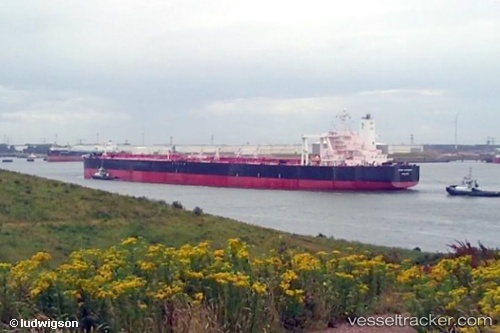
The current position of vessel NATALINA 7 is 2.29854 lat / 102.027 lng. Updated: 2024-04-23 17:58:40 UTC

Currently sailing under the flag of Panama

NATALINA 7 built in 2006 year

Port of registry:
Hong Kong (city and special administrative region of China)
Deadweight:
298971 t

Gross tonnage:
159730
Service entry:
2006-01-01T00:00:00Z
Details:


Last coordinates of the vessel:
UTC, 2.29821, 102.027, course: 119, speed: 0
UTC, 2.2985, 102.027, course: 121, speed: 0
UTC, 2.29856, 102.027, course: 123, speed: 0
2024-04-23 17:58:40 UTC, 2.29854, 102.027, course: 124, speed: 0

Track of the vessel in the last 14 days


Most frequent ports a vessels calls at NATALINA 7 (352001509):

Sambu, traffic: 7
Singapore, traffic: 5
Az Zarqa Island, traffic: 2
Tomakomai, traffic: 2
Das Island, traffic: 2
Ube, traffic: 2
Fateh Terminal, traffic: 2
Ras Tannurah, traffic: 2
Strait Of Gibraltar, traffic: 1
Uno, traffic: 1
Honshu, traffic: 1
Matsuga-hana, traffic: 1
Kiire, traffic: 1
Mina Az Zawr, traffic: 1
Qingdao, traffic: 1

Link to the map:


Find another ship

NATALINA_7 (352001509) last ports (portcalls and passsages)

Singapore | 2024-01-13 02:28:29
Sambu | 2024-01-13 02:02:07
Qingdao | 2023-04-10 05:03:12
Strait Of Gibraltar | 2023-02-05 02:04:38
Shimotsui | 2022-05-12 04:30:10
Matsuga-hana | 2022-05-12 01:54:46
Honshu | 2022-05-10 01:14:06
Kiire | 2022-05-05 04:43:51
Mina Az Zawr | 2022-04-14 03:00:04
Fateh Terminal | 2022-04-11 21:00:27
Tomakomai | 2022-03-08 00:20:08
Ras Tannurah | 2022-02-04 21:35:07
Sambu | 2022-01-19 18:35:42
Ube | 2021-12-27 19:50:19
Sambu | 2021-12-18 16:15:50
Sambu | 2021-12-18 15:30:07
Das Island | 2021-12-05 23:54:52
Az Zarqa Island | 2021-12-05 09:07:40