vessel DIA IMO: 9723071, Crude Oil Tanker vesseltracker.com
Vessel DIA IMO: 9723071, Crude Oil Tanker
MMSI: 228427800 callsign: FMSW size: 60x336

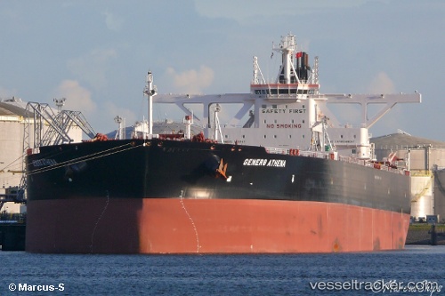
Find the position of the vessel DIA on the map. The latter are known coordinates and path.

marine traffic ship tracker show on live map

The current position of vessel DIA is 35.4388 lat / 129.397 lng. Updated: 2024-04-16 17:00:30 UTC

Currently sailing under the flag of France (RIF)

DIA built in 2015 year

Port of registry:
Majuro (coral atoll, capital of the Marshall Islands)
Deadweight:
299999 t

Payload_mass:
299999 tonne
Gross tonnage:
157092
Service entry:
2015-01-01T00:00:00Z

Manufacturer:
Hanwha Ocean (shipbuilder of South Korea)
Details:


Last coordinates of the vessel:
UTC, 35.4383, 129.397, course: -1, speed: 0
UTC, 35.4387, 129.397, course: 269, speed: 0
2024-04-16 17:00:30 UTC, 35.4388, 129.397, course: 268, speed: 0

Track of the vessel in the last 14 days


Most frequent ports a vessels calls at DIA (228427800):

Sambu, traffic: 4
Singapore, traffic: 4
Cape Of Good Hope, traffic: 2
Maassluis, traffic: 2
Selat Sunda, traffic: 2
Vlaardingen, traffic: 1
Fujairah, traffic: 1
Kole, traffic: 1
Pointe Noire, traffic: 1
Ulsan, traffic: 1

Link to the map:


Find another ship

DIA (228427800) last ports (portcalls and passsages)

Ulsan | 2024-04-14 07:01:39
Singapore | 2024-04-05 14:05:31
Singapore | 2023-08-24 01:16:39
Sambu | 2023-08-23 23:20:40
Vlaardingen | 2023-06-03 12:08:24
Maassluis | 2023-06-02 10:19:59
Maassluis | 2023-05-29 09:59:47
Kole | 2023-04-18 22:52:49
Pointe Noire | 2023-02-01 06:11:54
Fujairah | 2022-03-07 08:45:08
Singapore | 2022-02-18 09:25:24
Selat Sunda | 2022-01-22 16:44:31
Cape Of Good Hope | 2021-12-05 00:55:38