 vesseltracker.com
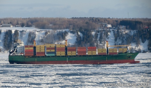
Find the position of the vessel DIAMANTIS P on the map. The latter are known coordinates and path.
marine traffic ship tracker show on live map
The current position of vessel DIAMANTIS P is -7.23997 lat / 5.57938 lng. Updated: 2024-04-24 17:56:05 UTCCurrently sailing under the flag of Liberia
DIAMANTIS P built in 1998 year
Port of registry:
Monrovia (capital city of Liberia)Deadweight:
30340 tPayload_mass:
30340 tonneGross tonnage:
23745Service entry:
1998-01-01T00:00:00ZManufacturer:
Stocznia Gdynia (shipyard in the Port of Gdynia, Poland)
Details:
Last coordinates of the vessel:
UTC, -7.87167, 5.85333, course: -1, speed: 16UTC, -7.62567, 5.75078, course: 339, speed: 15.9
UTC, -7.59875, 5.73947, course: 339, speed: 15.8
2024-04-24 17:56:05 UTC, -7.23997, 5.57938, course: 338, speed: 15.9