vessel KALAMOS IMO: 9560766, Crude Oil Tanker vesseltracker.com
Vessel KALAMOS IMO: 9560766, Crude Oil Tanker
MMSI: 636021297 callsign: 5LDG5 size: 60x333

Find the position of the vessel KALAMOS on the map. The latter are known coordinates and path.

marine traffic ship tracker show on live map

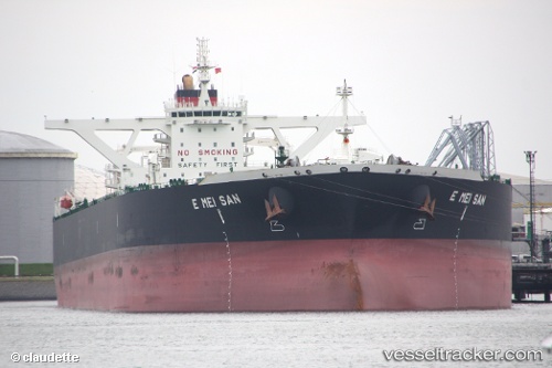
The current position of vessel KALAMOS is 11.9423 lat / 113.192 lng. Updated: 2024-04-19 20:15:43 UTC

Currently sailing under the flag of Liberia

KALAMOS built in 2010 year

Deadweight:
317952 t

Payload_mass:
317952 tonne
Gross tonnage:
163882
Service entry:
2010-01-01T00:00:00Z
Details:


Last coordinates of the vessel:
UTC, 12.6782, 113.817, course: 220, speed: 15.5
UTC, 12.4677, 113.626, course: 220, speed: 15.2
UTC, 12.0845, 113.313, course: 215, speed: 15.1
2024-04-19 20:15:43 UTC, 11.9423, 113.192, course: 221, speed: 15.3

Track of the vessel in the last 14 days


Most frequent ports a vessels calls at KALAMOS (636021297):

Sambu, traffic: 6
Singapore, traffic: 5
Angra Dos Reis, traffic: 2
Taku Bar, traffic: 2
Dagu Bar, traffic: 2
Az Zarqa Island, traffic: 1
Ulsan, traffic: 1
Cape Lopez, traffic: 1
Vishakhapatnam, traffic: 1
Dagu, traffic: 1
Das Island, traffic: 1
Fujairah, traffic: 1
Mutrah, traffic: 1
Ta-Ku, traffic: 1

Link to the map:


Find another ship

KALAMOS (636021297) last ports (portcalls and passsages)

Ta-Ku | 2024-04-11 23:47:21
Taku Bar | 2024-04-11 21:49:19
Singapore | 2024-03-25 02:08:56
Angra Dos Reis | 2024-02-23 14:28:32
Angra Dos Reis | 2024-02-18 06:12:23
Ulsan | 2023-11-27 00:09:06
Singapore | 2023-11-18 04:29:36
Az Zarqa Island | 2023-11-04 18:45:40
Fujairah | 2023-11-03 03:21:34
Sambu | 2023-09-23 12:43:37
Dagu Bar | 2023-07-09 10:09:34
Taku Bar | 2023-07-09 09:05:29
Singapore | 2023-06-19 16:32:02
Mutrah | 2023-06-07 16:35:50
Das Island | 2023-06-02 18:34:28
Vishakhapatnam | 2023-05-05 23:26:20
Singapore | 2023-02-28 23:13:35
Singapore | 2023-02-19 17:02:40
Sambu | 2023-02-19 08:28:36
Cape Lopez | 2023-01-18 08:50:43