vessel KAN TAN 222 IMO: 9545780, Offshore Tug/Supply Ship vesseltracker.com
Vessel KAN TAN 222 IMO: 9545780, Offshore Tug/Supply Ship
MMSI: 413337590 callsign: BOXO7 size: 18x65

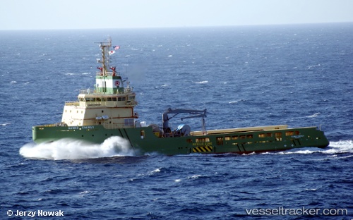
Find the position of the vessel KAN TAN 222 on the map. The latter are known coordinates and path.

marine traffic ship tracker show on live map

The current position of vessel KAN TAN 222 is 20.5896 lat / 108.467 lng. Updated: 2024-04-18 22:54:57 UTC

Currently sailing under the flag of China Peopless Republic

KAN TAN 222 built in 2011 year

Deadweight:
3170 t

Gross tonnage:
3260
Service entry:
2011-01-01T00:00:00Z
Details:


Last coordinates of the vessel:
UTC, 20.5896, 108.467, course: 183, speed: 0.2
UTC, 20.5895, 108.467, course: 136, speed: 0.3
UTC, 20.5893, 108.467, course: 146, speed: 0.1
2024-04-18 22:54:57 UTC, 20.5896, 108.467, course: 172, speed: 0

Track of the vessel in the last 14 days


Most frequent ports a vessels calls at KAN TAN 222 (413337590):

Pei-Hai, traffic: 8
Shekou, traffic: 3
Da Chan Bay, traffic: 2
Dalien, traffic: 1
Singapore, traffic: 1
Basuo Gang, traffic: 1
Dalian, traffic: 1

Link to the map:


Find another ship

KAN_TAN_222 (413337590) last ports (portcalls and passsages)

Pei-Hai | 2024-03-29 10:26:27
Pei-Hai | 2024-03-21 20:33:59
Pei-Hai | 2024-03-12 19:59:53
Pei-Hai | 2024-03-04 23:14:57
Pei-Hai | 2024-02-29 22:01:34
Da Chan Bay | 2023-12-04 02:23:58
Dalien | 2023-10-18 03:17:59
Da Chan Bay | 2023-09-13 02:57:22
Shekou | 2023-09-13 02:20:36
Basuo Gang | 2023-07-10 07:35:58
Pei-Hai | 2023-04-24 08:55:11
Pei-Hai | 2023-04-01 13:19:45
Pei-Hai | 2023-03-23 15:05:33
Shekou | 2023-02-11 05:43:42
Singapore | 2021-12-01 00:17:22