vessel 'FLAG ZANNIS' IMO: 9474682, vesseltracker.com
Vessel 'FLAG ZANNIS' IMO: 9474682,
MMSI: 355356000 callsign: size: x

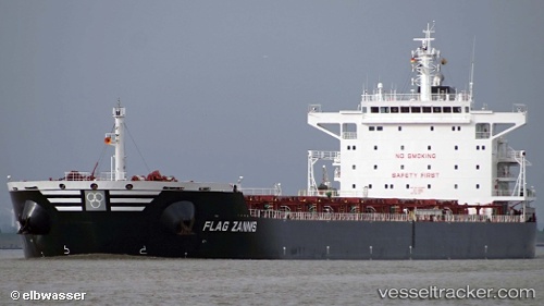
Find the position of the vessel 'FLAG ZANNIS' on the map. The latter are known coordinates and path.

marine traffic ship tracker show on live map

The current position of vessel 'FLAG ZANNIS' is 46.401 lat / 152.369 lng. Updated: 2024-04-19 19:04:24 UTC
Speed:
14.7 knot
Payload_mass:
79167 tonne
Gross tonnage:
43767
Service entry:
2014-01-01T00:00:00Z
Details:


Last coordinates of the vessel:
UTC, 46.5098, 152.569, course: 230, speed: 11.5
UTC, 46.4517, 152.461, course: 234, speed: 11.3
UTC, 46.4117, 152.39, course: -1, speed: 10
2024-04-19 19:04:24 UTC, 46.401, 152.369, course: 234, speed: 11

Track of the vessel in the last 14 days


Most frequent ports a vessels calls at 'FLAG ZANNIS' (355356000):

Sambu, traffic: 15
Singapore, traffic: 6
Santos, traffic: 2
Tsugaru-Kaikyo, traffic: 2
Tuticorin, traffic: 2
Fangcheng, traffic: 2
Paradip, traffic: 2
Prince Rupert, traffic: 2
Rio Grande, traffic: 1
Trincomalee, traffic: 1
Haldia, traffic: 1
Kandla, traffic: 1

Link to the map:


Find another ship

'FLAG_ZANNIS' (355356000) last ports (portcalls and passsages)

Fangcheng | 2024-01-10 22:18:23
Fangcheng | 2024-01-06 21:43:25
Sambu | 2023-12-30 01:29:13
Kandla | 2022-12-22 08:31:22
Paradip | 2022-11-29 18:06:16
Trincomalee | 2022-11-26 05:46:19
Tuticorin | 2022-10-20 10:45:46
Tuticorin | 2022-10-16 07:59:20
Paradip | 2022-10-06 01:10:39
Haldia | 2022-10-01 11:59:41
Singapore | 2022-07-18 22:21:25
Rio Grande | 2022-06-09 04:58:44
Singapore | 2022-04-17 09:12:07
Sambu | 2022-04-17 09:04:57
Santos | 2022-03-10 03:55:19
Sambu | 2022-01-02 08:35:36
Singapore | 2022-01-02 07:50:27
Sambu | 2022-01-02 07:50:07
Sambu | 2022-01-02 07:45:25
Sambu | 2022-01-02 07:40:25
Tsugaru-Kaikyo | 2021-12-21 05:35:27
Prince Rupert | 2021-12-01 00:06:10