vessel GAS ROYALE IMO: 9526992, LPG Tanker vesseltracker.com
Vessel GAS ROYALE IMO: 9526992, LPG Tanker
MMSI: 525121028 callsign: YDRR2 size: 106x106

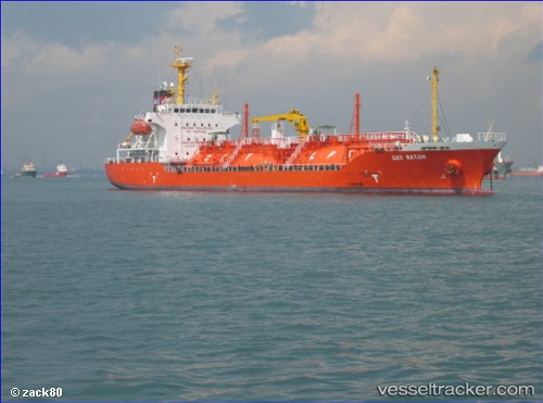
Find the position of the vessel GAS ROYALE on the map. The latter are known coordinates and path.

marine traffic ship tracker show on live map

The current position of vessel GAS ROYALE is -6.80852 lat / 113.297 lng. Updated: 2024-04-20 08:00:02 UTC

Currently sailing under the flag of Indonesia

GAS ROYALE built in 2011 year

Deadweight:
5292 t

Details:


Last coordinates of the vessel:
UTC, -6.75428, 112.765, course: 105, speed: 10.5
UTC, -6.80934, 112.969, course: 86, speed: 10.3
UTC, -6.80154, 113.097, course: 86, speed: 10.4
2024-04-20 08:00:02 UTC, -6.80852, 113.297, course: 86, speed: 10.4

Track of the vessel in the last 14 days


Most frequent ports a vessels calls at GAS ROYALE (525121028):

Sambu, traffic: 19
Port Swettenham, traffic: 14
Singapore, traffic: 8
Port Kelang, traffic: 6
Semarang, traffic: 3
Tanjung Perak, traffic: 1
Tanjong Perak, traffic: 1

Link to the map:


Find another ship

GAS_ROYALE (525121028) last ports (portcalls and passsages)

Tanjung Perak | 2023-06-20 20:08:13
Semarang | 2023-04-01 10:35:29
Semarang | 2023-01-12 05:28:20
Semarang | 2023-01-06 14:33:15
Sambu | 2022-02-12 15:41:18
Port Swettenham | 2022-02-06 12:25:01
Sambu | 2022-02-03 14:05:54
Port Swettenham | 2022-01-01 13:50:06
Port Kelang | 2022-01-01 13:45:36
Port Swettenham | 2021-12-28 15:15:05
Sambu | 2021-12-27 07:45:18
Singapore | 2021-12-27 07:40:05
Singapore | 2021-12-27 07:20:45
Sambu | 2021-12-25 16:15:27
Sambu | 2021-12-25 15:56:08
Sambu | 2021-12-25 15:50:46
Sambu | 2021-12-25 15:45:38
Port Swettenham | 2021-12-21 05:40:00
Port Swettenham | 2021-12-14 11:30:02
Port Swettenham | 2021-12-01 00:15:29