 vesseltracker.com
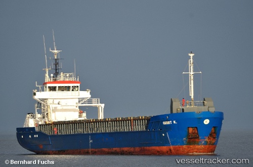
Find the position of the vessel GEERT on the map. The latter are known coordinates and path.
marine traffic ship tracker show on live map
The current position of vessel GEERT is 43.4437 lat / -3.82748 lng. Updated: 2024-04-19 11:31:49 UTCCurrently sailing under the flag of Barbados
GEERT built in 2001 year
Deadweight:
3785 tGross tonnage:
2545Service entry:
2001-01-01T00:00:00ZManufacturer:
Damen Shipyards BergumDetails:
Last coordinates of the vessel:
UTC, 43.4437, -3.82751, course: 188, speed: 0UTC, 43.4437, -3.82751, course: 188, speed: 0
UTC, 43.4437, -3.82748, course: 188, speed: 0
2024-04-19 11:31:49 UTC, 43.4437, -3.82748, course: 189, speed: 0