vessel TAE YOUNG IMO: 9218832, vesseltracker.com
Vessel TAE YOUNG IMO: 9218832,
MMSI: 441263000 callsign: size: x

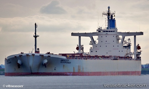
Find the position of the vessel TAE YOUNG on the map. The latter are known coordinates and path.

marine traffic ship tracker show on live map

The current position of vessel TAE YOUNG is -30.9268 lat / 153.344 lng. Updated: 2024-04-19 08:03:35 UTC
Payload_mass:
172559 tonne
Gross tonnage:
87430
Service entry:
2002-01-01T00:00:00Z

Manufacturer:
NKK
Details:


Last coordinates of the vessel:
UTC, -30.357, 153.496, course: 193, speed: 10.8
UTC, -30.8272, 153.378, course: 193, speed: 11
UTC, -30.8924, 153.356, course: 192, speed: 11.1
2024-04-19 08:03:35 UTC, -30.9268, 153.344, course: 193, speed: 11.3

Track of the vessel in the last 14 days


Most frequent ports a vessels calls at TAE YOUNG (441263000):

San Nicolas, traffic: 13
Algeciras, traffic: 1
Strait Of Gibraltar, traffic: 1

Link to the map:


Find another ship

TAE_YOUNG (441263000) last ports (portcalls and passsages)

Algeciras | 2023-12-20 21:50:06
Strait Of Gibraltar | 2023-12-20 03:34:51
San Nicolas | 2023-01-02 17:03:12
San Nicolas | 2022-10-08 13:46:21
San Nicolas | 2022-10-04 11:06:10
San Nicolas | 2022-09-30 10:16:52
San Nicolas | 2022-09-26 10:11:07
San Nicolas | 2022-09-22 08:01:16
San Nicolas | 2022-05-27 19:53:03
San Nicolas | 2022-05-23 19:49:29
San Nicolas | 2022-05-19 16:37:17
San Nicolas | 2022-05-15 13:53:05
San Nicolas | 2022-05-11 13:19:14
San Nicolas | 2022-05-07 13:12:52
San Nicolas | 2022-02-07 16:50:13