vessel Jingu IMO: 9021423, Vehicles Carrier
vesseltracker.com
Vessel Jingu IMO: 9021423, Vehicles Carrier
MMSI: 353662000 callsign: 3FBA size: 29x195

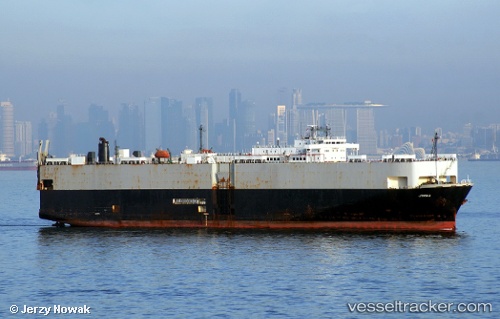
Find the position of the vessel Jingu on the map. The latter are known coordinates and path.

marine traffic ship tracker show on live map

The current position of vessel Jingu is -27.989 lat / -19.1884 lng. Updated: 2024-04-20 09:52:15 UTC
Payload_mass:
17216 tonne
Gross tonnage:
42164
Service entry:
1992-01-01T00:00:00Z

Manufacturer:
Shinkurushima Toyohashi Shipbuilding
Details:


Last coordinates of the vessel:
UTC, -27.89, -19.7732, course: 108, speed: 9.3
UTC, -27.9217, -19.5883, course: -1, speed: 9
UTC, -27.9506, -19.422, course: 102, speed: 9.4
2024-04-20 09:52:15 UTC, -27.989, -19.1884, course: 105, speed: 8.9

Track of the vessel in the last 14 days


Most frequent ports a vessels calls at Jingu (353662000):

Sambu, traffic: 7
Singapore, traffic: 6
Qingdao, traffic: 3
Sao Luiz, traffic: 3
Narvik, traffic: 2
Port Said, traffic: 2
Sept Iles, traffic: 2
Lianyungang, traffic: 1
Port Headland, traffic: 1
Dampier, traffic: 1
Port Hedland, traffic: 1
Ponta da Madeira, traffic: 1
Port Walcot, traffic: 1
Samson Point, traffic: 1
Bur Ibrahim, traffic: 1

Link to the map:


Find another ship

Jingu (353662000) last ports (portcalls and passsages)

Singapore | 2024-02-08 01:08:01
Ponta da Madeira | 2023-12-27 09:58:21
Singapore | 2023-11-21 05:05:14
Sambu | 2023-10-26 05:07:22
Lianyungang | 2023-07-30 03:54:25
Sambu | 2023-07-15 11:44:37
Singapore | 2023-05-01 08:13:32
Qingdao | 2023-04-13 12:30:27
Qingdao | 2023-04-09 09:36:12
Singapore | 2023-03-25 21:04:08
Samson Point | 2022-12-06 11:29:24
Qingdao | 2022-11-13 11:10:39
Dampier | 2022-07-20 16:19:26
Port Headland | 2022-06-16 07:25:45
Sambu | 2022-05-05 10:44:32
Bur Ibrahim | 2022-04-16 18:26:33
Port Said | 2022-04-16 09:25:06
Sept Iles | 2022-03-13 11:30:04
Narvik | 2022-02-07 16:46:38
Sao Luiz | 2022-01-05 23:34:18