vessel New Discovery IMO: 9269075, Crude Oil Tanker vesseltracker.com
Vessel New Discovery IMO: 9269075, Crude Oil Tanker
MMSI: 636019831 callsign: D5WJ3 size: 274x48

Find the position of the vessel New Discovery on the map. The latter are known coordinates and path.

marine traffic ship tracker show on live map

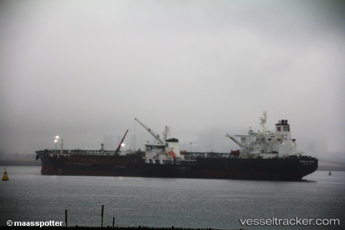
The current position of vessel New Discovery is 35.994 lat / -6.74958 lng. Updated: 2024-04-16 09:45:08 UTC

Currently sailing under the flag of Liberia

Gross tonnage:
81074
Service entry:
2003-01-01T00:00:00Z

Manufacturer:
Hyundai Heavy Industries (company)

Details:


Last coordinates of the vessel:
UTC, 35.9599, -6.13709, course: 271, speed: 13.3
UTC, 35.9617, -6.26632, course: 272, speed: 12.6
UTC, 35.9906, -6.60725, course: 275, speed: 13.3
2024-04-16 09:45:08 UTC, 35.994, -6.74958, course: 270, speed: 13.4

Track of the vessel in the last 14 days


Most frequent ports a vessels calls at New Discovery (636019831):

Sambu, traffic: 10
Port Said, traffic: 4
Singapore, traffic: 4
Algeciras, traffic: 3
Ceuta, traffic: 2
Nakhodka, traffic: 1
Novorossiysk, traffic: 1
Ra’S Shukhayr, traffic: 1
Bur Ibrahim, traffic: 1
Canakkale, traffic: 1
Uskudar, traffic: 1
Ambarli, traffic: 1
Fujairah, traffic: 1
Gelibolu, traffic: 1
Istanbul, traffic: 1

Link to the map:


Find another ship

New_Discovery (636019831) last ports (portcalls and passsages)

Ra’S Shukhayr | 2024-01-10 02:54:39
Bur Ibrahim | 2024-01-09 15:58:50
Port Said | 2024-01-09 06:45:48
Canakkale | 2024-01-05 12:23:50
Gelibolu | 2024-01-05 10:24:27
Ambarli | 2023-12-28 09:32:59
Uskudar | 2023-12-28 06:22:54
Novorossiysk | 2023-12-24 14:53:35
Algeciras | 2022-12-23 11:29:46
Algeciras | 2022-12-07 23:25:25
Algeciras | 2022-11-17 00:06:28
Ceuta | 2022-11-03 08:48:01
Ceuta | 2022-09-21 07:52:15
Port Said | 2022-07-21 16:26:44
Fujairah | 2022-05-10 07:31:47
Nakhodka | 2022-04-04 06:01:54
Sambu | 2021-12-24 22:05:37
Sambu | 2021-12-24 22:05:05
Sambu | 2021-12-24 21:40:27
Sambu | 2021-12-24 21:30:26
Port Said | 2021-12-02 06:30:26