vessel NAVE QUASAR IMO: 9514559, Crude Oil Tanker vesseltracker.com
Vessel NAVE QUASAR IMO: 9514559, Crude Oil Tanker
MMSI: 636020771 callsign: 5LAQ4 size: 60x330

Find the position of the vessel NAVE QUASAR on the map. The latter are known coordinates and path.

marine traffic ship tracker show on live map

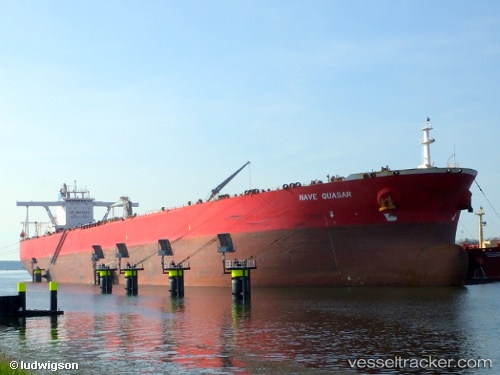
The current position of vessel NAVE QUASAR is 24.6457 lat / 58.3952 lng. Updated: 2024-04-20 05:44:54 UTC

Currently sailing under the flag of Liberia

NAVE QUASAR built in 2010 year

Deadweight:
297376 t

Payload_mass:
297376 tonne
Gross tonnage:
152727
Service entry:
2010-01-01T00:00:00Z
Details:


Last coordinates of the vessel:
UTC, 24.8669, 58.0823, course: 128, speed: 12.6
UTC, 24.773, 58.2196, course: 129, speed: 12.4
UTC, 24.6496, 58.39, course: 130, speed: 11.9
2024-04-20 05:44:54 UTC, 24.6457, 58.3952, course: 130, speed: 11.9

Track of the vessel in the last 14 days


Most frequent ports a vessels calls at NAVE QUASAR (636020771):

Sambu, traffic: 8
Singapore, traffic: 6
Incheon, traffic: 1
Montego Bay, traffic: 1
Mutrah, traffic: 1
Ras Tannurah, traffic: 1
Ulsan, traffic: 1
Port Elizabeth, traffic: 1

Link to the map:


Find another ship

NAVE_QUASAR (636020771) last ports (portcalls and passsages)

Ras Tannurah | 2024-04-15 20:32:16
Singapore | 2024-03-09 16:27:01
Singapore | 2024-02-19 12:49:32
Mutrah | 2023-12-01 14:23:05
Sambu | 2023-11-17 06:06:03
Singapore | 2023-11-15 14:46:02
Sambu | 2023-09-18 03:16:34
Sambu | 2023-08-02 00:59:26
Singapore | 2023-07-16 02:22:12
Singapore | 2023-06-08 01:55:43
Sambu | 2023-05-16 00:24:34
Incheon | 2023-03-30 04:34:56
Ulsan | 2023-03-26 01:40:14
Port Elizabeth | 2023-02-24 17:25:18
Montego Bay | 2023-01-31 11:22:12