 vesseltracker.com
Find the position of the vessel OB RIVER on the map. The latter are known coordinates and path.
marine traffic ship tracker show on live map
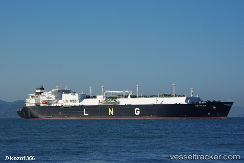
The current position of vessel OB RIVER is -2.425 lat / 132.673 lng. Updated: 2024-04-24 00:38:17 UTCCurrently sailing under the flag of Marshall Islands
OB RIVER built in 2007 year
Port of registry:
Majuro (coral atoll, capital of the Marshall Islands)Deadweight:
84682 tPayload_mass:
84682 tonneGross tonnage:
100244Service entry:
2007-01-01T00:00:00ZManufacturer:
Hyundai Heavy Industries (company)
Details:
Last coordinates of the vessel:
UTC, -2.42333, 132.673, course: -1, speed: 0UTC, -2.42333, 132.673, course: -1, speed: 0
UTC, -2.42333, 132.673, course: -1, speed: 0
2024-04-24 00:38:17 UTC, -2.425, 132.673, course: -1, speed: 0