 vesseltracker.com
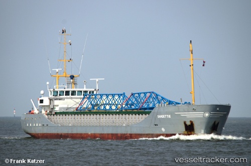
Find the position of the vessel Sandettie on the map. The latter are known coordinates and path.
marine traffic ship tracker show on live map
The current position of vessel Sandettie is 44.665 lat / -4.64667 lng. Updated: 2024-04-18 18:29:52 UTCCurrently sailing under the flag of Netherlands
Sandettie built in 2004 year
Port of registry:
Harlingen (town in Friesland, the Netherlands)Speed:
10.5 knotDeadweight:
2934 tPayload_mass:
2934 tonneBeam:
12.5 metreService entry:
2004-01-01T00:00:00ZManufacturer:
Thecla Bodewes Shipyards (Dutch shipbuilding company)Details:
Last coordinates of the vessel:
UTC, 44.8983, -4.43833, course: -1, speed: 9UTC, 44.7433, -4.57333, course: -1, speed: 9
UTC, 44.7033, -4.60667, course: -1, speed: 9
2024-04-18 18:29:52 UTC, 44.665, -4.64667, course: -1, speed: 9