vessel LIBERTY IMO: 9433016, Oil Products Tanker vesseltracker.com
Vessel LIBERTY IMO: 9433016, Oil Products Tanker
MMSI: 538009942 callsign: V7A5371 size: 32x228

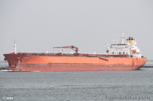
Find the position of the vessel LIBERTY on the map. The latter are known coordinates and path.

marine traffic ship tracker show on live map

Currently sailing under the flag of Marshall Islands

LIBERTY built in 2009 year

Port of registry:
Monrovia (capital city of Liberia)
Deadweight:
74862 t

Gross tonnage:
42340
Service entry:
2009-01-01T00:00:00Z
Details:


Track of the vessel in the last 14 days


Most frequent ports a vessels calls at LIBERTY (538009942):

Bur Ibrahim, traffic: 4
Flushing, traffic: 4
Vlissingen, traffic: 4
Maassluis, traffic: 3
Strait Of Gibraltar, traffic: 2
Terneuzen, traffic: 2
Ijmuiden, traffic: 2
Zeebrugge, traffic: 2
Port Said, traffic: 2
Puerto De La Luz, traffic: 2
Ras Gharib, traffic: 2
Vlaardingen, traffic: 1
La Spezia, traffic: 1
Las Palmas, traffic: 1
Singapore, traffic: 1

Link to the map:


Find another ship

LIBERTY (538009942) last ports (portcalls and passsages)

Singapore | 2023-07-02 12:25:42
La Spezia | 2022-12-05 17:50:00
Vlaardingen | 2022-03-29 03:40:02
Maassluis | 2022-03-29 03:30:02
Port Said | 2022-03-17 13:00:22
Bur Ibrahim | 2022-03-17 04:00:01
Ras Gharib | 2022-02-02 02:01:31
Bur Ibrahim | 2022-02-01 17:10:09
Strait Of Gibraltar | 2022-01-24 19:35:01
Ijmuiden | 2022-01-13 11:40:01
Vlissingen | 2021-12-20 15:25:51
Terneuzen | 2021-12-19 22:00:45
Flushing | 2021-12-19 20:48:54
Zeebrugge | 2021-12-19 19:22:14
Puerto De La Luz | 2021-12-10 05:41:50