 vesseltracker.com
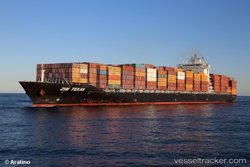
Find the position of the vessel '636020782' on the map. The latter are known coordinates and path.
marine traffic ship tracker show on live map
The current position of vessel '636020782' is -25.6605 lat / 33.0132 lng. Updated: 2024-04-20 01:08:43 UTCPort of registry:
Majuro (coral atoll, capital of the Marshall Islands)Payload_mass:
50133.9 tonneGross tonnage:
40542Service entry:
2011-01-01T00:00:00ZManufacturer:
Jiangsu Yangzi Xinfu ShipbuildingDetails:
Last coordinates of the vessel:
UTC, -25.645, 33.0333, course: -1, speed: 0UTC, -25.6467, 33.0317, course: -1, speed: 0
UTC, -25.6583, 33.0133, course: -1, speed: 0
2024-04-20 01:08:43 UTC, -25.6605, 33.0132, course: 11, speed: 0.4