 Gateway
Current Status
Where is the vessel?
Gateway is currently in Near Wangerooge, based on AIS data received about 15h ago.
Latest AIS update:
Current position: 53.93046° N, 7.94091° E (Near Wangerooge)
Average speed (last 7 days): Loading…
Average speed (last 30 days): Loading…
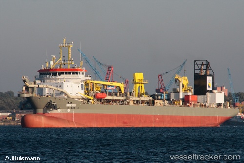
Vessel profile: Gateway is a Hopper Dredger with dimensions 137m x 137m.
This page combines live AIS, route history, probable destination signals, nearby traffic, and port activity for practical vessel monitoring.
The current position of vessel Gateway is 53.93046 lat / 7.94091 lng. Updated: 2026-05-23 10:22:01 UTCNearest reference points:
- Near Wangerooge
- Near Helgoland
- 10 nm E of Wangerooge
Currently sailing under the flag of Cyprus ![]()
Gateway built in 2010 year
Deadweight:
21200 tDetails:
Live Vessel Gateway Analytics (details, animations, etc.)
Recent AIS points (UTC):
2026-05-23 07:42:04 UTC · 53.93402, 7.95622 · SOG 15.6 kn · COG 240°2026-05-23 08:00:49 UTC · 53.91555, 7.91782 · SOG 1.5 kn · COG 112°
2026-05-23 10:22:01 UTC · 53.93046, 7.94091 · SOG 12.9 kn · COG 52°
2026-05-23 10:22:01 UTC · 53.93046, 7.94091 · SOG 12.9 kn · COG 52°