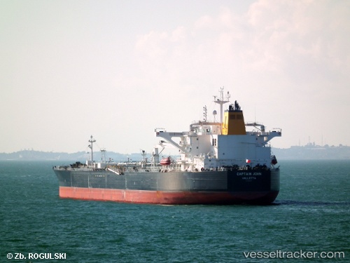
 Captain John
Current Status
Where is the vessel?
Captain John is currently in 120 nm SW of Utiel, based on AIS data received about 15h ago.
Latest AIS update:
Current position: 38.62378° N, 13.43873° W (120 nm SW of Utiel)
Average speed (last 7 days): Loading…
Average speed (last 30 days): Loading…
Vessel profile: Captain John is a Crude Oil Tanker with dimensions 251m x 45m.
This page combines live AIS, route history, probable destination signals, nearby traffic, and port activity for practical vessel monitoring.
The current position of vessel Captain John is 38.62378 lat / -13.43873 lng. Updated: 2026-05-24 05:37:15 UTCNearest reference points:
- 97 nm W of Los Ramos
- 95 nm W of Los Ramos
- 94 nm W of Los Ramos
Currently sailing under the flag of Malta ![]()
Details:
Live Vessel Captain John Analytics (details, animations, etc.)
Recent AIS points (UTC):
2026-05-24 01:43:54 UTC · 39.09527, -14.23840 · SOG 11.9 kn · COG 126°2026-05-24 03:53:59 UTC · 38.83460, -13.79279 · SOG 12 kn · COG 127°
2026-05-24 04:33:05 UTC · 38.75374, -13.66057 · SOG 12.3 kn · COG 128°
2026-05-24 05:37:15 UTC · 38.62378, -13.43873 · SOG 11.9 kn · COG 124°