 SAADET
Current Status
Where is the vessel?
SAADET is currently in 32 nm NW of Guernsey, based on AIS data received about 14h ago.
Latest AIS update:
Current position: 49.66259° N, 3.31993° W (32 nm NW of Guernsey)
Average speed (last 7 days): Loading…
Average speed (last 30 days): Loading…
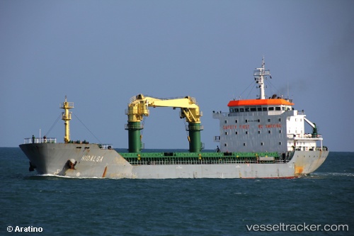
Vessel profile: SAADET is a General Cargo Ship with dimensions 140m x 20m.
This page combines live AIS, route history, probable destination signals, nearby traffic, and port activity for practical vessel monitoring.
The current position of vessel SAADET is 49.66259 lat / -3.31993 lng. Updated: 2026-05-24 05:13:44 UTCNearest reference points:
- 23 nm NW of Saint Sampson
- 16 nm SE of Brixham
- 27 nm N of Verzy
Currently sailing under the flag of Malta ![]()
SAADET built in 2009 year
Deadweight:
12223 tDetails:
Live Vessel SAADET Analytics (details, animations, etc.)
Recent AIS points (UTC):
2026-05-24 01:19:13 UTC · 49.35771, -4.11439 · SOG 9.7 kn · COG 62°2026-05-24 01:44:00 UTC · 49.39139, -4.02689 · SOG 9.5 kn · COG 62°
2026-05-24 03:53:23 UTC · 49.56395, -3.58631 · SOG 9.1 kn · COG 64°
2026-05-24 05:13:44 UTC · 49.66259, -3.31993 · SOG 8.6 kn · COG 67°