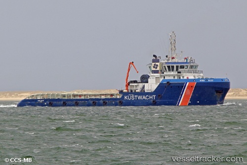
 IEVOLI BLACK
Current Status
Where is the vessel?
IEVOLI BLACK is currently in Near KYLE OF LOCHALSH, based on AIS data received about 14h ago.
Latest AIS update:
Current position: 57.27911° N, 5.71395° W (Near KYLE OF LOCHALSH)
Average speed (last 7 days): Loading…
Average speed (last 30 days): Loading…
Vessel profile: IEVOLI BLACK is a Anchor Handling Vessel with dimensions m x m.
This page combines live AIS, route history, probable destination signals, nearby traffic, and port activity for practical vessel monitoring.
The current position of vessel IEVOLI BLACK is 57.27911 lat / -5.71395 lng. Updated: 2026-05-23 13:56:23 UTCNearest reference points:
- Near KYLE OF LOCHALSH
- Near Fishnish, Isle of Mull
- Near CRAIGNURE PIER
Currently sailing under the flag of United Kingdom ![]()
Details:
Live Vessel IEVOLI BLACK Analytics (details, animations, etc.)
Recent AIS points (UTC):
2026-05-23 11:14:20 UTC · 57.27910, -5.71394 · SOG 0 kn · COG 265°2026-05-23 11:35:22 UTC · 57.27911, -5.71394 · SOG 0 kn · COG 265°
2026-05-23 13:35:20 UTC · 57.27911, -5.71394 · SOG 0 kn · COG 266°
2026-05-23 13:56:23 UTC · 57.27911, -5.71395 · SOG 0 kn · COG 266°