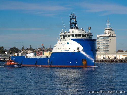
 SURFER TIDE
Current Status
Where is the vessel?
SURFER TIDE is currently in Near Bridge of Don, based on AIS data received about 15h ago.
Latest AIS update:
Current position: 57.18539° N, 2.04060° W (Near Bridge of Don)
Average speed (last 7 days): Loading…
Average speed (last 30 days): Loading…
Vessel profile: SURFER TIDE is a Other Type with dimensions m x m.
This page combines live AIS, route history, probable destination signals, nearby traffic, and port activity for practical vessel monitoring.
The current position of vessel SURFER TIDE is 57.18539 lat / -2.04060 lng. Updated: 2026-05-23 11:37:50 UTCNearest reference points:
- Near Aberdeen
- Near PETERHEAD
- Near Peterhead
Currently sailing under the flag of United Kingdom ![]()
Details:
Live Vessel SURFER TIDE Analytics (details, animations, etc.)
Recent AIS points (UTC):
2026-05-23 07:58:50 UTC · 57.18547, -2.04124 · SOG 0.1 kn · COG 216°2026-05-23 09:46:17 UTC · 57.18514, -2.04075 · SOG 0.2 kn · COG 227°
2026-05-23 11:13:19 UTC · 57.18543, -2.04066 · SOG 0 kn · COG 207°
2026-05-23 11:37:50 UTC · 57.18539, -2.04060 · SOG 0.1 kn · COG 221°