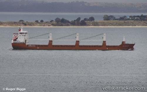
Molengracht
Current StatusWhere is the vessel?
Molengracht is currently in Near Burns Harbor, based on AIS data received about 14h ago.
Latest AIS update:
Current position: 41.63993° N, 87.15035° W (Near Burns Harbor)
Average speed (last 7 days): Loading…
Average speed (last 30 days): Loading…
Vessel profile: Molengracht is a General Cargo Ship with dimensions 19m x 143m.
This page combines live AIS, route history, probable destination signals, nearby traffic, and port activity for practical vessel monitoring.
The current position of vessel Molengracht is 41.63993 lat / -87.15035 lng. Updated: 2026-05-23 13:42:14 UTCNearest reference points:
- Near Burns Harbor
- Near Burnham
- Near WAUKEGAN
Details:
Live Vessel Molengracht Analytics (details, animations, etc.)
Recent AIS points (UTC):
2026-05-23 11:04:50 UTC · 41.63992, -87.15034 · SOG 0 kn · COG -1°2026-05-23 12:09:21 UTC · 41.63993, -87.15036 · SOG 0 kn · COG -1°
2026-05-23 13:33:16 UTC · 41.63996, -87.15037 · SOG 0 kn · COG 180°
2026-05-23 13:42:14 UTC · 41.63993, -87.15035 · SOG 0 kn · COG 180°