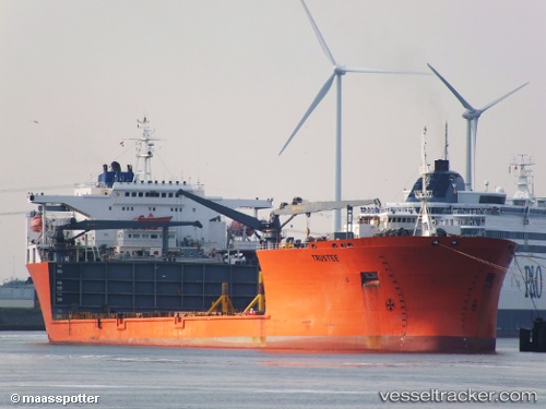
 TRUSTEE
Current Status
Where is the vessel?
TRUSTEE is currently in 12 nm SE of Saint Leonards-on-Sea, based on AIS data received about 14h ago.
Latest AIS update:
Current position: 50.71869° N, 0.79207° E (12 nm SE of Saint Leonards-on-Sea)
Average speed (last 7 days): Loading…
Average speed (last 30 days): Loading…
Vessel profile: TRUSTEE is a Heavy Lift Vessel with dimensions m x m.
This page combines live AIS, route history, probable destination signals, nearby traffic, and port activity for practical vessel monitoring.
The current position of vessel TRUSTEE is 50.71869 lat / 0.79207 lng. Updated: 2026-05-23 17:43:29 UTCNearest reference points:
- Near Saint Leonards-on-Sea
- Near Dungeness
- 23 nm S of Poling
Currently sailing under the flag of Malta ![]()
Details:
Live Vessel TRUSTEE Analytics (details, animations, etc.)
Recent AIS points (UTC):
2026-05-23 14:16:44 UTC · 51.16986, 1.67380 · SOG 14.1 kn · COG 230°2026-05-23 15:56:01 UTC · 50.93510, 1.23441 · SOG 11.8 kn · COG 221°
2026-05-23 16:02:00 UTC · 50.92089, 1.21308 · SOG 11.7 kn · COG 221°
2026-05-23 17:43:29 UTC · 50.71869, 0.79207 · SOG 12 kn · COG 233°