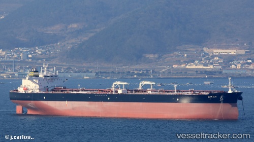
Matala
Current StatusWhere is the vessel?
Matala is currently in 243 nm W of River Sao Nicolau, based on AIS data received about 15h ago.
Latest AIS update:
Current position: 13.37308° S, 8.27020° E (243 nm W of River Sao Nicolau)
Average speed (last 7 days): Loading…
Average speed (last 30 days): Loading…
Vessel profile: Matala is a Crude Oil Tanker with dimensions 49m x 279m.
This page combines live AIS, route history, probable destination signals, nearby traffic, and port activity for practical vessel monitoring.
The current position of vessel Matala is -13.37308 lat / 8.27020 lng. Updated: 2026-05-23 16:04:27 UTCNearest reference points:
- Open sea, approx. 400 nm off the nearest listed port
- Open sea, approx. 406 nm off the nearest listed port
- Open sea, approx. 401 nm off the nearest listed port
Details:
Live Vessel Matala Analytics (details, animations, etc.)
Recent AIS points (UTC):
2026-05-23 13:16:27 UTC · -12.81110, 8.02008 · SOG 13.1 kn · COG 155°2026-05-23 14:16:58 UTC · -13.01167, 8.10833 · SOG 13 kn · COG -1°
2026-05-23 15:57:59 UTC · -13.35093, 8.26136 · SOG 13 kn · COG 157°
2026-05-23 16:04:27 UTC · -13.37308, 8.27020 · SOG 13 kn · COG 156°