 JESPER
Current Status
Where is the vessel?
JESPER is currently in 366 nm S of Svenica, based on AIS data received about 14h ago.
Latest AIS update:
Current position: 40.05717° N, 154.11424° E (366 nm S of Svenica)
Average speed (last 7 days): Loading…
Average speed (last 30 days): Loading…
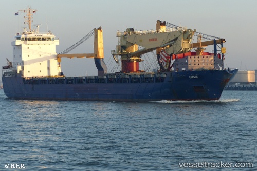
Vessel profile: JESPER is a General Cargo with dimensions m x m.
This page combines live AIS, route history, probable destination signals, nearby traffic, and port activity for practical vessel monitoring.
The current position of vessel JESPER is 40.05717 lat / 154.11424 lng. Updated: 2026-05-23 19:49:29 UTCNearest reference points:
- Open sea, approx. 403 nm off the nearest listed port
- Open sea, approx. 405 nm off the nearest listed port
- Open sea, approx. 406 nm off the nearest listed port
Currently sailing under the flag of Antigua and Barbuda ![]()
Details:
Live Vessel JESPER Analytics (details, animations, etc.)
Recent AIS points (UTC):
2026-05-23 16:15:09 UTC · 39.80975, 153.44420 · SOG 9.2 kn · COG 55°2026-05-23 17:24:52 UTC · 39.89963, 153.64249 · SOG 9.3 kn · COG 65°
2026-05-23 18:57:16 UTC · 40.00588, 153.94069 · SOG 9.5 kn · COG 67°
2026-05-23 19:49:29 UTC · 40.05717, 154.11424 · SOG 9.6 kn · COG 69°