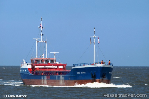
 CM COAST
Current Status
Where is the vessel?
CM COAST is currently in 14 nm N of Fermanville, based on AIS data received about 14h ago.
Latest AIS update:
Current position: 49.90043° N, 1.56471° W (14 nm N of Fermanville)
Average speed (last 7 days): Loading…
Average speed (last 30 days): Loading…
Vessel profile: CM COAST is a General Cargo with dimensions m x m.
This page combines live AIS, route history, probable destination signals, nearby traffic, and port activity for practical vessel monitoring.
The current position of vessel CM COAST is 49.90043 lat / -1.56471 lng. Updated: 2026-05-24 03:53:22 UTCNearest reference points:
- Near Équeurdreville
- Near Cherbourg
- 22 nm S of Holbury
Currently sailing under the flag of Antigua and Barbuda ![]()
Details:
Live Vessel CM COAST Analytics (details, animations, etc.)
Recent AIS points (UTC):
2026-05-24 00:22:42 UTC · 50.09576, -1.01839 · SOG 7.3 kn · COG 248°2026-05-24 01:22:32 UTC · 50.03700, -1.17237 · SOG 6.6 kn · COG 248°
2026-05-24 01:48:00 UTC · 50.01257, -1.23353 · SOG 6.5 kn · COG 250°
2026-05-24 03:53:22 UTC · 49.90043, -1.56471 · SOG 8.1 kn · COG 248°