 GH CALLAS
Current Status
Where is the vessel?
GH CALLAS is currently in 57 nm N of Brebes, based on AIS data received about 14h ago.
Latest AIS update:
Current position: 7.83333° N, 109.50500° E (57 nm N of Brebes)
Average speed (last 7 days): Loading…
Average speed (last 30 days): Loading…
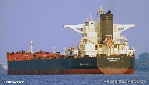
Vessel profile: GH CALLAS is a Bulk Carrier with dimensions m x m.
This page combines live AIS, route history, probable destination signals, nearby traffic, and port activity for practical vessel monitoring.
The current position of vessel GH CALLAS is 7.83333 lat / 109.50500 lng. Updated: 2026-05-23 13:25:33 UTCNearest reference points:
- 41 nm NW of Brebes
- 30 nm SW of Dai Hung (Tandem Load)
- 11 nm N of Gombong
Currently sailing under the flag of Bermuda ![]()
Details:
Live Vessel GH CALLAS Analytics (details, animations, etc.)
Recent AIS points (UTC):
2026-05-23 10:04:34 UTC · 7.26500, 109.32333 · SOG 10 kn · COG -1°2026-05-23 12:15:30 UTC · 7.63674, 109.43299 · SOG 10.5 kn · COG 19°
2026-05-23 13:16:35 UTC · 7.80833, 109.49500 · SOG 11 kn · COG -1°
2026-05-23 13:25:33 UTC · 7.83333, 109.50500 · SOG 11 kn · COG -1°