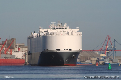
Alliance Norfolk
Current StatusWhere is the vessel?
Alliance Norfolk is currently in 167 nm SW of Southampton, based on AIS data received about 14h ago.
Latest AIS update:
Current position: 30.07080° N, 66.86872° W (167 nm SW of Southampton)
Average speed (last 7 days): Loading…
Average speed (last 30 days): Loading…
Vessel profile: Alliance Norfolk is a Vehicles Carrier with dimensions 22m x 200m.
This page combines live AIS, route history, probable destination signals, nearby traffic, and port activity for practical vessel monitoring.
The current position of vessel Alliance Norfolk is 30.07080 lat / -66.86872 lng. Updated: 2026-05-23 12:19:50 UTCDetails:
Live Vessel Alliance Norfolk Analytics (details, animations, etc.)
Recent AIS points (UTC):
2026-05-23 07:38:53 UTC · 29.57385, -68.20283 · SOG 16 kn · COG 69°2026-05-23 09:28:48 UTC · 29.77473, -67.68632 · SOG 16.1 kn · COG 69°
2026-05-23 10:15:47 UTC · 29.86193, -67.46567 · SOG 16 kn · COG 69°
2026-05-23 12:19:50 UTC · 30.07080, -66.86872 · SOG 16.2 kn · COG 65°