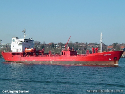
 SILENT I
Current Status
Where is the vessel?
SILENT I is currently in Near Klagstorp, based on AIS data received about 14h ago.
Latest AIS update:
Current position: 55.23180° N, 13.39678° E (Near Klagstorp)
Average speed (last 7 days): Loading…
Average speed (last 30 days): Loading…
Vessel profile: SILENT I is a Oil Products Tanker with dimensions m x m.
This page combines live AIS, route history, probable destination signals, nearby traffic, and port activity for practical vessel monitoring.
The current position of vessel SILENT I is 55.23180 lat / 13.39678 lng. Updated: 2026-05-23 12:22:57 UTCNearest reference points:
- Near Trelleborg
- Near Oxie
- Near Malmo
Currently sailing under the flag of Saint Kitts and Nevis ![]()
Details:
Live Vessel SILENT I Analytics (details, animations, etc.)
Recent AIS points (UTC):
2026-05-23 08:00:28 UTC · 55.35849, 14.47368 · SOG 9.3 kn · COG 221°2026-05-23 10:20:51 UTC · 55.22176, 13.95310 · SOG 9.6 kn · COG 274°
2026-05-23 10:20:51 UTC · 55.22176, 13.95310 · SOG 9.6 kn · COG 274°
2026-05-23 12:22:57 UTC · 55.23180, 13.39678 · SOG 9.3 kn · COG 273°