 ATA VOYAGER
Current Status
Where is the vessel?
ATA VOYAGER is currently in 205 nm W of Upper Northfield, based on AIS data received about 14h ago.
Latest AIS update:
Current position: 21.21001° N, 49.20045° W (205 nm W of Upper Northfield)
Average speed (last 7 days): Loading…
Average speed (last 30 days): Loading…
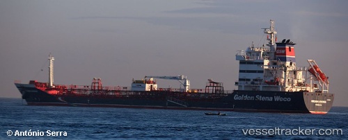
Vessel profile: ATA VOYAGER is a Oil/Chemical Tanker with dimensions m x m.
This page combines live AIS, route history, probable destination signals, nearby traffic, and port activity for practical vessel monitoring.
The current position of vessel ATA VOYAGER is 21.21001 lat / -49.20045 lng. Updated: 2026-05-23 10:29:40 UTCCurrently sailing under the flag of Panama ![]()
Details:
Live Vessel ATA VOYAGER Analytics (details, animations, etc.)
Recent AIS points (UTC):
2026-05-23 07:11:30 UTC · 21.31332, -48.64611 · SOG 9.6 kn · COG 255°2026-05-23 08:04:46 UTC · 21.28667, -48.79667 · SOG 9 kn · COG -1°
2026-05-23 09:28:45 UTC · 21.24500, -49.03167 · SOG 9 kn · COG -1°
2026-05-23 10:29:40 UTC · 21.21001, -49.20045 · SOG 9.3 kn · COG 251°