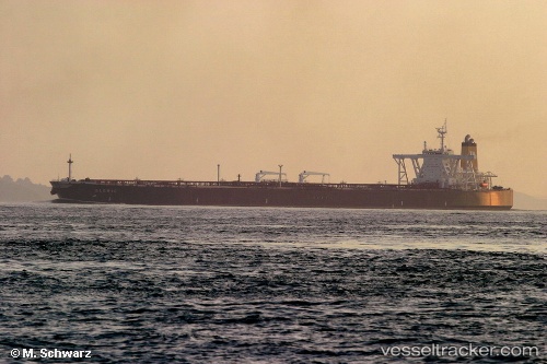
 TEJAS
TEJAS
Current Status
Where is the vessel?
TEJAS is currently in 53 nm NW of Basco, based on AIS data received about 14h ago.
Latest AIS update:
Current position: 21.17413° N, 121.42196° E (53 nm NW of Basco)
Average speed (last 7 days): Loading…
Average speed (last 30 days): Loading…
Vessel profile: TEJAS is a Tanker with dimensions m x m.
This page combines live AIS, route history, probable destination signals, nearby traffic, and port activity for practical vessel monitoring.
The current position of vessel TEJAS is 21.17413 lat / 121.42196 lng. Updated: 2026-05-23 13:54:46 UTCNearest reference points:
- 66 nm W of Basco
- 26 nm SE of Kaohsiung
- 106 nm W of Basco
Currently sailing under the flag of Panama ![]()
Details:
Live Vessel TEJAS Analytics (details, animations, etc.)
Recent AIS points (UTC):
2026-05-23 10:57:59 UTC · 21.53835, 121.78325 · SOG 10.6 kn · COG 201°2026-05-23 12:05:50 UTC · 21.37656, 121.67199 · SOG 10.4 kn · COG 231°
2026-05-23 13:41:30 UTC · 21.19945, 121.45307 · SOG 10.5 kn · COG -1°
2026-05-23 13:54:46 UTC · 21.17413, 121.42196 · SOG 10.5 kn · COG -1°