 HONG BANG
Current Status
Where is the vessel?
HONG BANG is currently in 104 nm NE of PANGKAL BALAM, based on AIS data received about 14h ago.
Latest AIS update:
Current position: 0.55776° S, 106.94363° E (104 nm NE of PANGKAL BALAM)
Average speed (last 7 days): Loading…
Average speed (last 30 days): Loading…
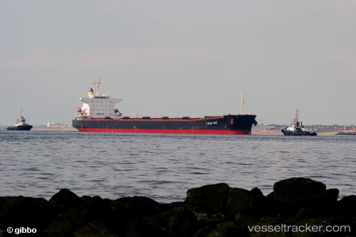
Vessel profile: HONG BANG is a Bulk Carrier with dimensions m x m.
This page combines live AIS, route history, probable destination signals, nearby traffic, and port activity for practical vessel monitoring.
The current position of vessel HONG BANG is -0.55776 lat / 106.94363 lng. Updated: 2026-05-23 23:21:51 UTCNearest reference points:
- 69 nm NE of Exspan
- 46 nm NW of Tanjung Pandan
- Near PANGKAL BALAM
Currently sailing under the flag of Panama ![]()
Details:
Live Vessel HONG BANG Analytics (details, animations, etc.)
Recent AIS points (UTC):
2026-05-23 18:56:26 UTC · -1.16240, 107.06461 · SOG 8.1 kn · COG 349°2026-05-23 21:41:25 UTC · -0.79160, 106.98917 · SOG 8.3 kn · COG -1°
2026-05-23 22:01:30 UTC · -0.74326, 106.97968 · SOG 8.3 kn · COG -1°
2026-05-23 23:21:51 UTC · -0.55776, 106.94363 · SOG 8.3 kn · COG -1°