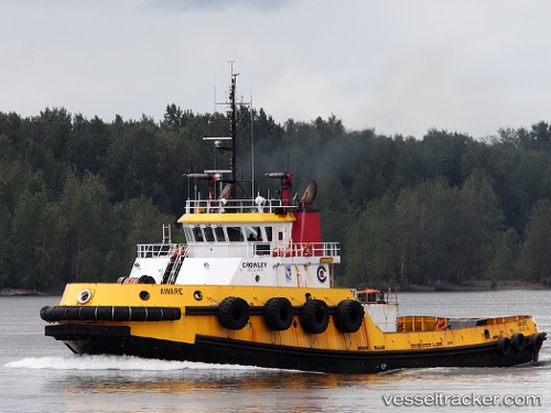
 Aware
Aware
Current Status
Where is the vessel?
Aware is currently in 48 nm NE of Cockburn Town, based on AIS data received about 14h ago.
Latest AIS update:
Current position: 24.53667° N, 73.82833° W (48 nm NE of Cockburn Town)
Average speed (last 7 days): Loading…
Average speed (last 30 days): Loading…
Vessel profile: Aware is a Tug with dimensions 38m x 13m.
This page combines live AIS, route history, probable destination signals, nearby traffic, and port activity for practical vessel monitoring.
The current position of vessel Aware is 24.53667 lat / -73.82833 lng. Updated: 2026-05-23 13:40:24 UTCNearest reference points:
- Near Great Exuma Island
- 31 nm E of Harbour Island
- 22 nm E of Harbour Island
Currently sailing under the flag of USA ![]()
Aware built in 2000 year
Details:
Live Vessel Aware Analytics (details, animations, etc.)
Recent AIS points (UTC):
2026-05-23 10:49:29 UTC · 24.21167, -73.40500 · SOG 10 kn · COG -1°2026-05-23 11:59:15 UTC · 24.34229, -73.57838 · SOG 10.5 kn · COG 309°
2026-05-23 13:34:24 UTC · 24.52500, -73.81333 · SOG 10 kn · COG -1°
2026-05-23 13:40:24 UTC · 24.53667, -73.82833 · SOG 10 kn · COG -1°