.

IN flag JAG ALAIA

Vessel type: Bulk Carrier | IMO: 9551727 | MMSI: MMSI: 419001597
Call sign: VTIW | Dimensions: 45 m x 292 m
Current Status

Where is the vessel?

JAG ALAIA is currently in 306 nm N of Cap Malheureux, based on AIS data received about 14h ago.

Latest AIS update:

Current position: 14.94510° S, 58.44235° E (306 nm N of Cap Malheureux)

Average speed (last 7 days): Loading…

Average speed (last 30 days): Loading…

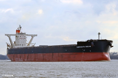
Vessel profile: JAG ALAIA is a Bulk Carrier with dimensions 45m x 292m.

This page combines live AIS, route history, probable destination signals, nearby traffic, and port activity for practical vessel monitoring.

The current position of vessel JAG ALAIA is -14.94510 lat / 58.44235 lng. Updated: 2026-05-23 09:41:44 UTC
More recent position available: 21 min ago
Free positions are delayed by 14 hours.

We recommend registering. If you register, paid vessel access will be saved in your profile. Guest access works only through a personal link.

Nearest reference points:
  • Open sea, approx. 401 nm off the nearest listed port
  • Open sea, approx. 402 nm off the nearest listed port
  • Open sea, approx. 403 nm off the nearest listed port

Currently sailing under the flag of India IN flag

JAG ALAIA built in 2014 year

Deadweight:
180694 t

Details:

Live Vessel JAG ALAIA Analytics (details, animations, etc.)


Recent AIS points (UTC):
2026-05-23 05:35:13 UTC · -14.34649, 59.04317 · SOG 12.1 kn · COG 223°
2026-05-23 07:20:48 UTC · -14.59825, 58.78547 · SOG 12.2 kn · COG 224°
2026-05-23 07:38:16 UTC · -14.64039, 58.74263 · SOG 12 kn · COG 224°
2026-05-23 09:41:44 UTC · -14.94510, 58.44235 · SOG 12.6 kn · COG 223°

UTC: --
Start: -- Track timeline (UTC) End: --
Encountered: --


Link to the map:


Find another ship

JAG_ALAIA (419001597) last ports (portcalls and passsages)

HUANGHUA | 2025-08-28 22:28:16
PENGERANG | 2025-08-14 20:25:19
TANAH MERAH | 2025-08-13 23:23:25
PULAU SAMBU | 2025-08-13 21:33:56
Strait Of Gibraltar | 2025-06-25 12:45:06
TARIFA | 2025-06-25 11:49:21
CARTEYA GUADARRANQUE | 2025-06-24 08:19:49
Arzew | 2025-06-23 07:12:18
Arzew | 2025-06-18 07:46:00
TANGER MED | 2025-06-16 11:22:02
Strait Of Gibraltar | 2025-06-16 09:31:55
Puerto De La Luz | 2025-06-13 09:51:28
TALIARTE | 2025-06-13 08:24:28
Nouadhibou | 2025-06-07 11:36:19
CASADO | 2025-06-07 10:23:43
Port Etienne | 2025-06-07 08:55:30
Krishnapatnam | 2024-09-26 04:39:57
Krishnapatnam | 2024-09-22 04:27:37
Singapore | 2024-09-15 23:01:14
Victoria | 2024-08-19 16:51:51
Vancouver | 2024-08-14 21:40:32
Vancouver | 2024-07-26 18:46:34
Vancouver | 2024-07-22 18:41:20
Vancouver | 2024-07-18 18:29:14
Vancouver | 2024-07-14 18:28:13
Tsugaru-Kaikyo | 2024-06-25 04:22:05
Selat Lombok | 2024-05-29 04:31:39
Port Headland | 2024-05-23 22:00:12
Port Headland | 2024-04-15 10:30:53
Taicang | 2024-03-31 22:38:42
Wusong | 2024-03-31 20:31:39
Jingjiang | 2024-03-31 14:34:43
Port Headland | 2024-03-13 06:25:23
Jingjiang | 2024-01-24 10:28:13
Wusong | 2024-01-24 05:35:24
Zhangjiagang | 2024-01-21 05:26:08
Nantong | 2024-01-21 03:13:33
Taicang | 2024-01-21 00:42:39
Wusong | 2024-01-19 23:28:32
Wusong | 2023-12-09 03:14:00
Vishakhapatnam | 2023-11-24 08:12:59
Vishakhapatnam | 2023-11-20 07:09:56
Vishakhapatnam | 2023-11-16 07:03:40
Strait Of Gibraltar | 2023-09-23 09:36:35
Bur Ibrahim | 2023-09-15 01:25:09
Ras Gharib | 2023-09-14 06:30:08
Ra’S Shukhayr | 2023-09-14 05:21:42
Fujairah | 2023-09-04 01:32:23
Port Elizabeth | 2023-08-03 04:43:59
Mormugao | 2023-05-26 09:27:21
Singapore | 2023-05-08 20:57:03
Sambu | 2023-05-08 20:07:08
Vancouver | 2023-04-04 20:05:21
Tsugaru-Kaikyo | 2023-02-18 05:35:40
Wusong | 2023-02-13 02:27:49
Wusong | 2023-02-07 05:23:20
Selat Lombok | 2023-01-14 08:43:50
Port Headland | 2023-01-10 08:31:52