 MAOMING
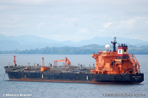
Current Status
Where is the vessel?
MAOMING is currently in Near RAJAEI, based on AIS data received about 14h ago.
Latest AIS update:
Current position: 27.12069° N, 56.11252° E (Near RAJAEI)
Average speed (last 7 days): Loading…
Average speed (last 30 days): Loading…
Vessel profile: MAOMING is a Oil/Chemical Tanker with dimensions m x m.
This page combines live AIS, route history, probable destination signals, nearby traffic, and port activity for practical vessel monitoring.
The current position of vessel MAOMING is 27.12069 lat / 56.11252 lng. Updated: 2026-05-23 21:16:14 UTCNearest reference points:
- Near RAJAEI
- Near SHAHID BAHONAR
- Near Shahid Rajaee Pt/Bandar Abbas
Currently sailing under the flag of Iran ![]()
Details:
Live Vessel MAOMING Analytics (details, animations, etc.)
Recent AIS points (UTC):
2026-05-23 19:21:14 UTC · 27.12075, 56.11259 · SOG 0 kn · COG -1°2026-05-23 21:16:14 UTC · 27.12069, 56.11252 · SOG 0 kn · COG -1°
2026-05-23 21:16:14 UTC · 27.12069, 56.11252 · SOG 0 kn · COG -1°
2026-05-23 21:16:14 UTC · 27.12069, 56.11252 · SOG 0 kn · COG -1°