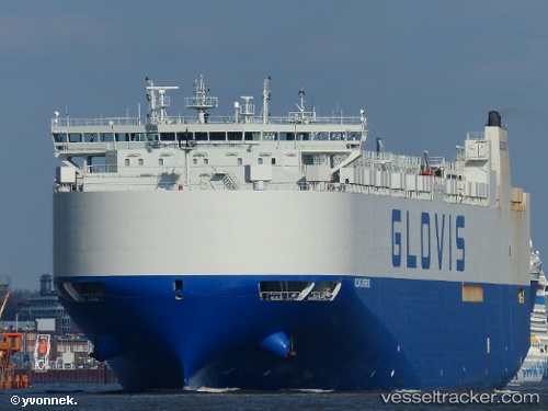
 GLOVIS SUPREME
Current Status
Where is the vessel?
GLOVIS SUPREME is currently in 24 nm S of Cape St. Francis, based on AIS data received about 15h ago.
Latest AIS update:
Current position: 34.57102° S, 24.74875° E (24 nm S of Cape St. Francis)
Average speed (last 7 days): Loading…
Average speed (last 30 days): Loading…
Vessel profile: GLOVIS SUPREME is a Vehicles Carrier with dimensions 35m x 199m.
This page combines live AIS, route history, probable destination signals, nearby traffic, and port activity for practical vessel monitoring.
The current position of vessel GLOVIS SUPREME is -34.57102 lat / 24.74875 lng. Updated: 2026-05-24 08:00:46 UTCNearest reference points:
- 21 nm S of Mount Pleasant
- Near Deal Party
Currently sailing under the flag of Korea (Republic of) ![]()
GLOVIS SUPREME built in 2013 year
Deadweight:
20138 tDetails:
Live Vessel GLOVIS SUPREME Analytics (details, animations, etc.)
Recent AIS points (UTC):
2026-05-24 04:32:33 UTC · -34.25379, 25.89675 · SOG 17.6 kn · COG 250°2026-05-24 05:53:28 UTC · -34.36917, 25.45031 · SOG 17.1 kn · COG 252°
2026-05-24 07:28:21 UTC · -34.51546, 24.92402 · SOG 17.1 kn · COG 249°
2026-05-24 08:00:46 UTC · -34.57102, 24.74875 · SOG 17.3 kn · COG 250°