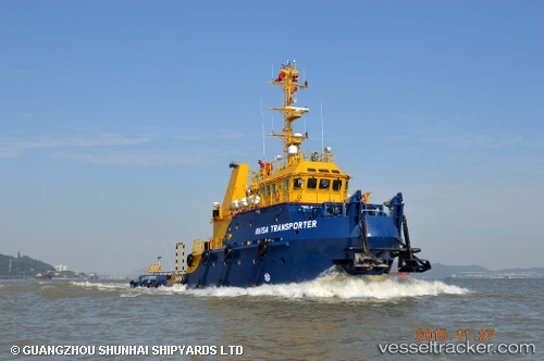
Avisa Transporter
Current StatusWhere is the vessel?
Avisa Transporter is currently in 20 nm NE of MIRI, based on AIS data received about 15h ago.
Latest AIS update:
Current position: 4.64808° N, 114.18989° E (20 nm NE of MIRI)
Average speed (last 7 days): Loading…
Average speed (last 30 days): Loading…
Vessel profile: Avisa Transporter is a Utility Vessel with dimensions 10m x 41m.
This page combines live AIS, route history, probable destination signals, nearby traffic, and port activity for practical vessel monitoring.
The current position of vessel Avisa Transporter is 4.64808 lat / 114.18989 lng. Updated: 2026-05-23 12:17:17 UTCNearest reference points:
- 11 nm N of MIRI
- Near MIRI
- Near Kikeh
Details:
Live Vessel Avisa Transporter Analytics (details, animations, etc.)
Recent AIS points (UTC):
2026-05-23 08:06:53 UTC · 4.75958, 114.17640 · SOG 0.1 kn · COG -1°2026-05-23 10:08:17 UTC · 4.64791, 114.18997 · SOG 0 kn · COG 258°
2026-05-23 10:23:17 UTC · 4.64794, 114.18996 · SOG 0 kn · COG 249°
2026-05-23 12:17:17 UTC · 4.64808, 114.18989 · SOG 0 kn · COG 239°