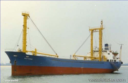
 GULF DAOUD
Current Status
Where is the vessel?
GULF DAOUD is currently in Near Tjirebon, based on AIS data received about 14h ago.
Latest AIS update:
Current position: 6.68984° S, 108.60903° E (Near Tjirebon)
Average speed (last 7 days): Loading…
Average speed (last 30 days): Loading…
Vessel profile: GULF DAOUD is a General Cargo Ship with dimensions 12m x 89m.
This page combines live AIS, route history, probable destination signals, nearby traffic, and port activity for practical vessel monitoring.
The current position of vessel GULF DAOUD is -6.68984 lat / 108.60903 lng. Updated: 2026-05-24 02:10:04 UTCNearest reference points:
- 25 nm N of Gunungsari
- 26 nm N of Pemalang
- 31 nm NE of Rengasdengklok
Currently sailing under the flag of Indonesia ![]()
GULF DAOUD built in 1983 year
Deadweight:
2419 tDetails:
Live Vessel GULF DAOUD Analytics (details, animations, etc.)
Recent AIS points (UTC):
2026-05-23 22:05:04 UTC · -6.68994, 108.60927 · SOG 0 kn · COG -1°2026-05-23 23:26:13 UTC · -6.68995, 108.60935 · SOG 0.1 kn · COG -1°
2026-05-24 02:04:34 UTC · -6.68985, 108.60922 · SOG 0.1 kn · COG -1°
2026-05-24 02:10:04 UTC · -6.68984, 108.60903 · SOG 0.1 kn · COG -1°