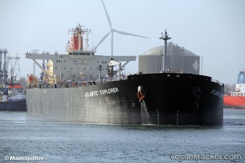
 ATLANTIC EXPLORER
Current Status
Where is the vessel?
ATLANTIC EXPLORER is currently in 21 nm SE of Malacca, based on AIS data received about 14h ago.
Latest AIS update:
Current position: 1.84340° N, 102.37225° E (21 nm SE of Malacca)
Average speed (last 7 days): Loading…
Average speed (last 30 days): Loading…
Vessel profile: ATLANTIC EXPLORER is a Crude Oil Tanker with dimensions m x m.
This page combines live AIS, route history, probable destination signals, nearby traffic, and port activity for practical vessel monitoring.
The current position of vessel ATLANTIC EXPLORER is 1.84340 lat / 102.37225 lng. Updated: 2026-05-24 06:24:40 UTCNearest reference points:
- 12 nm S of Tangkak
- 29 nm W of Parit Raja
- Near Malacca
Currently sailing under the flag of Malaysia ![]()
Details:
Live Vessel ATLANTIC EXPLORER Analytics (details, animations, etc.)
Recent AIS points (UTC):
2026-05-24 02:13:22 UTC · 2.24455, 102.12210 · SOG 0 kn · COG -1°2026-05-24 03:27:31 UTC · 2.24800, 102.10758 · SOG 4.4 kn · COG 267°
2026-05-24 04:34:01 UTC · 2.08537, 102.06932 · SOG 12.7 kn · COG 150°
2026-05-24 06:24:40 UTC · 1.84340, 102.37225 · SOG 13.2 kn · COG 116°