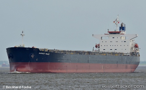
Harvest Peace
Current StatusWhere is the vessel?
Harvest Peace is currently in 13 nm S of PORT DICKSON, based on AIS data received about 14h ago.
Latest AIS update:
Current position: 2.31865° N, 101.73205° E (13 nm S of PORT DICKSON)
Average speed (last 7 days): Loading…
Average speed (last 30 days): Loading…
Vessel profile: Harvest Peace is a Bulk Carrier with dimensions 32m x 225m.
This page combines live AIS, route history, probable destination signals, nearby traffic, and port activity for practical vessel monitoring.
The current position of vessel Harvest Peace is 2.31865 lat / 101.73205 lng. Updated: 2026-05-23 22:08:11 UTCNearest reference points:
- 13 nm SW of PORT DICKSON
- Near PORT DICKSON
- 14 nm W of SUNGAI UDANG
Details:
Live Vessel Harvest Peace Analytics (details, animations, etc.)
Recent AIS points (UTC):
2026-05-23 19:06:21 UTC · 2.65730, 101.23966 · SOG 12.3 kn · COG 110°2026-05-23 20:13:21 UTC · 2.54332, 101.43572 · SOG 11.8 kn · COG 125°
2026-05-23 21:47:51 UTC · 2.35598, 101.68043 · SOG 11.3 kn · COG 125°
2026-05-23 22:08:11 UTC · 2.31865, 101.73205 · SOG 11.2 kn · COG 125°