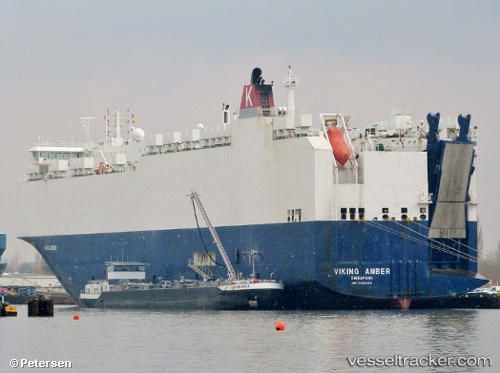
 VIKING AMBER
Current Status
Where is the vessel?
VIKING AMBER is currently in 11 nm SW of KARINGON, based on AIS data received about 15d ago.
Latest AIS update:
Current position: 57.98387° N, 11.11341° E (11 nm SW of KARINGON)
Average speed (last 7 days): Loading…
Average speed (last 30 days): Loading…
Vessel profile: VIKING AMBER is a Vehicles Carrier with dimensions 167m x 28m.
This page combines live AIS, route history, probable destination signals, nearby traffic, and port activity for practical vessel monitoring.
The current position of vessel VIKING AMBER is 57.98387 lat / 11.11341 lng. Updated: 2026-05-08 03:05:23 UTCNearest reference points:
- Near SMOGEN
- Near Ellös
- Near Brofjorden
Currently sailing under the flag of Marshall Islands ![]()
VIKING AMBER built in 2010 year
Deadweight:
12471 tDetails:
Live Vessel VIKING AMBER Analytics (details, animations, etc.)
Recent AIS points (UTC):
2026-05-08 03:05:23 UTC · 57.98387, 11.11341 · SOG 0.9 kn · COG 158°2026-05-08 03:05:23 UTC · 57.98387, 11.11341 · SOG 0.9 kn · COG 158°
2026-05-08 03:05:23 UTC · 57.98387, 11.11341 · SOG 0.9 kn · COG 158°
2026-05-08 03:05:23 UTC · 57.98387, 11.11341 · SOG 0.9 kn · COG 158°