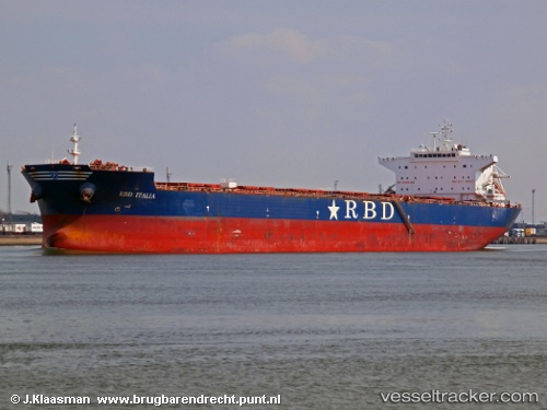
 ROSEWOOD
Current Status
Where is the vessel?
ROSEWOOD is currently in Near CAM PHA, based on AIS data received about 15h ago.
Latest AIS update:
Current position: 20.90565° N, 107.26823° E (Near CAM PHA)
Average speed (last 7 days): Loading…
Average speed (last 30 days): Loading…
Vessel profile: ROSEWOOD is a Bulk Carrier with dimensions m x m.
This page combines live AIS, route history, probable destination signals, nearby traffic, and port activity for practical vessel monitoring.
The current position of vessel ROSEWOOD is 20.90565 lat / 107.26823 lng. Updated: 2026-05-23 10:24:52 UTCNearest reference points:
- 18 nm SE of Ha Long
- 14 nm SE of Nam Hai Dinh Vu Port
- 12 nm SE of Nam Hai Dinh Vu Port
Currently sailing under the flag of Marshall Islands ![]()
Details:
Live Vessel ROSEWOOD Analytics (details, animations, etc.)
Recent AIS points (UTC):
2026-05-23 07:30:48 UTC · 20.90562, 107.26827 · SOG 0.1 kn · COG 189°2026-05-23 08:12:49 UTC · 20.90566, 107.26810 · SOG 0.1 kn · COG 186°
2026-05-23 10:03:47 UTC · 20.90562, 107.26828 · SOG 0 kn · COG 190°
2026-05-23 10:24:52 UTC · 20.90565, 107.26823 · SOG 0.1 kn · COG 191°