 SYMI
SYMI
Current Status
Where is the vessel?
SYMI is currently in 399 nm SE of Masirah, based on AIS data received about 14h ago.
Latest AIS update:
Current position: 15.25577° N, 63.22153° E (399 nm SE of Masirah)
Average speed (last 7 days): Loading…
Average speed (last 30 days): Loading…
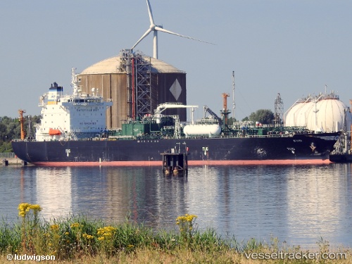
Vessel profile: SYMI is a Lpg Tanker with dimensions m x m.
This page combines live AIS, route history, probable destination signals, nearby traffic, and port activity for practical vessel monitoring.
The current position of vessel SYMI is 15.25577 lat / 63.22153 lng. Updated: 2026-05-23 18:43:21 UTCNearest reference points:
- Open sea, approx. 400 nm off the nearest listed port
- Open sea, approx. 402 nm off the nearest listed port
- Open sea, approx. 403 nm off the nearest listed port
Currently sailing under the flag of Marshall Islands ![]()
Details:
Live Vessel SYMI Analytics (details, animations, etc.)
Recent AIS points (UTC):
2026-05-23 12:50:08 UTC · 16.36103, 63.43029 · SOG 11.8 kn · COG 192°2026-05-23 15:52:06 UTC · 15.78896, 63.32172 · SOG 11.8 kn · COG 187°
2026-05-23 17:55:50 UTC · 15.40458, 63.24893 · SOG 11.2 kn · COG 187°
2026-05-23 18:43:21 UTC · 15.25577, 63.22153 · SOG 11.7 kn · COG 187°