 NOUR 1
Current Status
Where is the vessel?
NOUR 1 is currently in Near Aliaga, based on AIS data received about 15h ago.
Latest AIS update:
Current position: 38.87299° N, 26.97383° E (Near Aliaga)
Average speed (last 7 days): Loading…
Average speed (last 30 days): Loading…
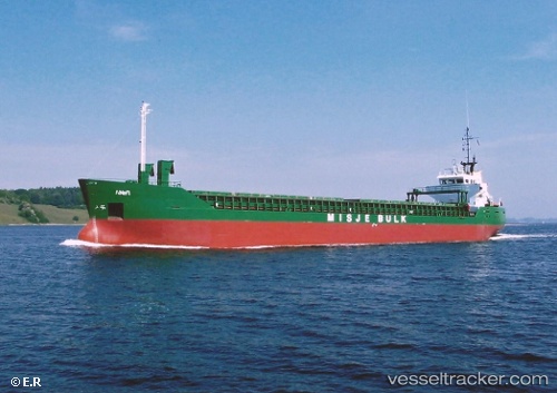
Vessel profile: NOUR 1 is a General Cargo with dimensions m x m.
This page combines live AIS, route history, probable destination signals, nearby traffic, and port activity for practical vessel monitoring.
The current position of vessel NOUR 1 is 38.87299 lat / 26.97383 lng. Updated: 2026-05-24 08:00:09 UTCNearest reference points:
- Near Aliaga
- Near Nemrut Bay
- Near NEMRUT
Currently sailing under the flag of Guinea ![]()
Details:
Live Vessel NOUR 1 Analytics (details, animations, etc.)
Recent AIS points (UTC):
2026-05-24 04:30:21 UTC · 38.87279, 26.97418 · SOG 0 kn · COG -1°2026-05-24 05:54:13 UTC · 38.87281, 26.97422 · SOG 0.1 kn · COG -1°
2026-05-24 07:24:11 UTC · 38.87303, 26.97380 · SOG 0 kn · COG -1°
2026-05-24 08:00:09 UTC · 38.87299, 26.97383 · SOG 0 kn · COG -1°