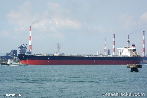
Sunny Link
Current StatusWhere is the vessel?
Sunny Link is currently in 367 nm S of Abakaliki, based on AIS data received about 14h ago.
Latest AIS update:
Current position: 0.32850° N, 87.15160° E (367 nm S of Abakaliki)
Average speed (last 7 days): Loading…
Average speed (last 30 days): Loading…
Vessel profile: Sunny Link is a Bulk Carrier with dimensions 45m x 289m.
This page combines live AIS, route history, probable destination signals, nearby traffic, and port activity for practical vessel monitoring.
The current position of vessel Sunny Link is 0.32850 lat / 87.15160 lng. Updated: 2026-05-23 13:18:02 UTCNearest reference points:
- Open sea, approx. 400 nm off the nearest listed port
- Open sea, approx. 401 nm off the nearest listed port
- Open sea, approx. 402 nm off the nearest listed port
Details:
Live Vessel Sunny Link Analytics (details, animations, etc.)
Recent AIS points (UTC):
2026-05-23 10:25:43 UTC · 0.64832, 87.54369 · SOG 10.6 kn · COG -1°2026-05-23 11:37:54 UTC · 0.51885, 87.37358 · SOG 10.6 kn · COG -1°
2026-05-23 13:18:02 UTC · 0.32850, 87.15160 · SOG 10.3 kn · COG -1°
2026-05-23 13:18:02 UTC · 0.32850, 87.15160 · SOG 10.3 kn · COG -1°